Bubenheim
Bubenheim
Jump to navigation
Jump to search
| Bubenheim | ||
|---|---|---|
| ||
 Bubenheim Location of Bubenheim within Donnersbergkreis district 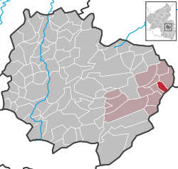 | ||
Coordinates: 49°37′39″N 8°7′05″E / 49.62750°N 8.11806°E / 49.62750; 8.11806Coordinates: 49°37′39″N 8°7′05″E / 49.62750°N 8.11806°E / 49.62750; 8.11806 | ||
| Country | Germany | |
| State | Rhineland-Palatinate | |
| District | Donnersbergkreis | |
| Municipal assoc. | Göllheim | |
| Government | ||
| • Mayor | Thomas Lebkücher | |
| Area | ||
| • Total | 2.94 km2 (1.14 sq mi) | |
| Elevation | 200 m (700 ft) | |
| Population (2017-12-31)[1] | ||
| • Total | 404 | |
| • Density | 140/km2 (360/sq mi) | |
| Time zone | CET/CEST (UTC+1/+2) | |
| Postal codes | 67308 | |
| Dialling codes | 06355 | |
| Vehicle registration | KIB | |
| Website | www.goellheim.de | |

Bubenheim is a municipality in the Donnersbergkreis district, in Rhineland-Palatinate, Germany. Bubenheim has an area of 2.94 km² and a population of 446 (as of December 31, 2006).
Towns and municipalities in Donnersbergkreis | ||
|---|---|---|
| ||
References[edit]
^ Statistisches Landesamt Rheinland-Pfalz "Bevölkerungsstand 2017 - Gemeindeebene" Check|url=value (help). Statistisches Landesamt Rheinland-Pfalz (in German). 2018..mw-parser-output cite.citationfont-style:inherit.mw-parser-output qquotes:"""""""'""'".mw-parser-output code.cs1-codecolor:inherit;background:inherit;border:inherit;padding:inherit.mw-parser-output .cs1-lock-free abackground:url("//upload.wikimedia.org/wikipedia/commons/thumb/6/65/Lock-green.svg/9px-Lock-green.svg.png")no-repeat;background-position:right .1em center.mw-parser-output .cs1-lock-limited a,.mw-parser-output .cs1-lock-registration abackground:url("//upload.wikimedia.org/wikipedia/commons/thumb/d/d6/Lock-gray-alt-2.svg/9px-Lock-gray-alt-2.svg.png")no-repeat;background-position:right .1em center.mw-parser-output .cs1-lock-subscription abackground:url("//upload.wikimedia.org/wikipedia/commons/thumb/a/aa/Lock-red-alt-2.svg/9px-Lock-red-alt-2.svg.png")no-repeat;background-position:right .1em center.mw-parser-output .cs1-subscription,.mw-parser-output .cs1-registrationcolor:#555.mw-parser-output .cs1-subscription span,.mw-parser-output .cs1-registration spanborder-bottom:1px dotted;cursor:help.mw-parser-output .cs1-hidden-errordisplay:none;font-size:100%.mw-parser-output .cs1-visible-errorfont-size:100%.mw-parser-output .cs1-subscription,.mw-parser-output .cs1-registration,.mw-parser-output .cs1-formatfont-size:95%.mw-parser-output .cs1-kern-left,.mw-parser-output .cs1-kern-wl-leftpadding-left:0.2em.mw-parser-output .cs1-kern-right,.mw-parser-output .cs1-kern-wl-rightpadding-right:0.2em
Authority control |
|
|---|
This Donnersbergkreis location article is a stub. You can help Wikipedia by expanding it. |
Categories:
- Municipalities in Rhineland-Palatinate
- Donnersbergkreis
- Donnersbergkreis geography stubs
(window.RLQ=window.RLQ||).push(function()mw.config.set("wgPageParseReport":"limitreport":"cputime":"0.744","walltime":"0.880","ppvisitednodes":"value":13758,"limit":1000000,"ppgeneratednodes":"value":0,"limit":1500000,"postexpandincludesize":"value":66236,"limit":2097152,"templateargumentsize":"value":18243,"limit":2097152,"expansiondepth":"value":26,"limit":40,"expensivefunctioncount":"value":7,"limit":500,"unstrip-depth":"value":1,"limit":20,"unstrip-size":"value":2769,"limit":5000000,"entityaccesscount":"value":1,"limit":400,"timingprofile":["100.00% 812.194 1 -total"," 88.81% 721.304 1 Template:Infobox_German_location"," 83.63% 679.212 1 Template:Infobox_settlement"," 70.71% 574.272 1 Template:Infobox"," 29.51% 239.678 7 Template:Population_Germany"," 24.52% 199.163 7 Template:Metadata_Population_DE-RP"," 8.70% 70.630 1 Template:Cite_web"," 4.57% 37.091 8 Template:Both"," 4.42% 35.875 12 Template:Str_left"," 4.10% 33.299 1 Template:Coord"],"scribunto":"limitreport-timeusage":"value":"0.325","limit":"10.000","limitreport-memusage":"value":5069076,"limit":52428800,"cachereport":"origin":"mw1293","timestamp":"20181018083353","ttl":1900800,"transientcontent":false);mw.config.set("wgBackendResponseTime":118,"wgHostname":"mw1322"););

 Clash Royale CLAN TAG