Kamikawa, Saitama
Kamikawa, Saitama
Jump to navigation
Jump to search
Kamikawa 神川町 | |||
|---|---|---|---|
Town | |||
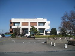
 Kamikawa town office | |||
| |||
 Location of Kamikawa in Saitama Prefecture | |||
 Kamikawa | |||
Coordinates: 36°12′50″N 139°6′6.2″E / 36.21389°N 139.101722°E / 36.21389; 139.101722Coordinates: 36°12′50″N 139°6′6.2″E / 36.21389°N 139.101722°E / 36.21389; 139.101722 | |||
| Country | Japan | ||
| Region | Kantō | ||
| Prefecture | Saitama Prefecture | ||
| District | Kodama | ||
| Area | |||
| • Total | 47.40 km2 (18.30 sq mi) | ||
| Population (February 2016) | |||
| • Total | 13,862 | ||
| • Density | 289/km2 (750/sq mi) | ||
| Time zone | UTC+9 (Japan Standard Time) | ||
| - Tree | Sakura | ||
| - Flower | Cosmos | ||
| - Bird | Japanese bush warbler | ||
| Phone number | 0495-77-2111 | ||
| Address | 909 Uetake, Kamikawa-machi, Kodama-gun, Saitama-ken 367-0292 | ||
| Website | http://www.town.kamikawa.saitama.jp/ | ||
Kamikawa (神川町, Kamikawa-machi) is a town located in Saitama Prefecture, Japan. As of 1 February 2016[update], the town had an estimated population of 13,862, and a population density of 289 persons per km². Its total area is 47.40 square kilometres (18.30 sq mi).
Contents
1 Geography
2 Surrounding municipalities
3 History
4 Economy
5 Education
6 Transportation
6.1 Railway
6.2 Highway
7 Local attractions
8 External links
Geography[edit]
Kamikawa is located on the extreme western border of Saitama Prefecture, separated from Gunma Prefecture by the Kanna River, and isolated from the remainder of Saitama by the Chichibu Mountains.
Surrounding municipalities[edit]
Saitama Prefecture- Honjō
- Chichibu
- Kamisato
- Minano
Gunma Prefecture- Fujioka
History[edit]
The village of Tanshō was created within Kami District, Saitama and the villages of Wakaizumi and Aoyagi were created within Kodama District, Saitama with the establishment of the municipalities system on April 1, 1889. Kami District was abolished in 1896, becoming part of Kodama District. On December 1, 1949, Wakaizumi split into Watarase and Aguhara.
On May 3, 1954 the Tanshō and Aoyagi merged to form the village of Kamikawa. Kamikawa annexed Watarase on May 3, 1957, and was elevated to town status on October 1, 1987. On January 1, 2006, Kamikawa merged with neighboring Kamiizumi village.
Economy[edit]
Kamikawa has some light manufacturing; however, many people commute to neighboring Honjō
Education[edit]
Kamikawa has four elementary schools and two middle schools.
Transportation[edit]
Railway[edit]
JR East - Hachikō Line- Tanshō
Highway[edit]
- Japan National Route 254
- Japan National Route 462
Local attractions[edit]
- Kanasana Shrine
- Mizube Koen
- Sanba Gorge
- Shimokubo Dam
- Shinsui Dam
External links[edit]
![]() Media related to Kamikawa, Saitama at Wikimedia Commons
Media related to Kamikawa, Saitama at Wikimedia Commons
Official Website (in Japanese)
Categories:
- Towns in Saitama Prefecture
(window.RLQ=window.RLQ||).push(function()mw.config.set("wgPageParseReport":"limitreport":"cputime":"0.368","walltime":"0.487","ppvisitednodes":"value":3741,"limit":1000000,"ppgeneratednodes":"value":0,"limit":1500000,"postexpandincludesize":"value":55847,"limit":2097152,"templateargumentsize":"value":11553,"limit":2097152,"expansiondepth":"value":23,"limit":40,"expensivefunctioncount":"value":8,"limit":500,"unstrip-depth":"value":0,"limit":20,"unstrip-size":"value":0,"limit":5000000,"entityaccesscount":"value":1,"limit":400,"timingprofile":["100.00% 409.624 1 -total"," 66.13% 270.877 1 Template:Infobox_settlement"," 43.23% 177.070 1 Template:Infobox"," 10.70% 43.833 1 Template:Short_description"," 9.07% 37.143 9 Template:Both"," 8.30% 34.013 1 Template:Coord"," 6.91% 28.304 1 Template:Nihongo"," 6.55% 26.843 1 Template:Convert"," 5.65% 23.154 1 Template:As_of"," 5.46% 22.346 2 Template:Category_handler"],"scribunto":"limitreport-timeusage":"value":"0.138","limit":"10.000","limitreport-memusage":"value":4689193,"limit":52428800,"cachereport":"origin":"mw2184","timestamp":"20181004180522","ttl":1900800,"transientcontent":false);mw.config.set("wgBackendResponseTime":75,"wgHostname":"mw2232"););


 Clash Royale CLAN TAG