Reed City, Michigan
Reed City, Michigan
Jump to navigation
Jump to search
| Reed City, Michigan | |
|---|---|
City | |
Motto(s): Your Crossroads Community on the Path to Progress... | |
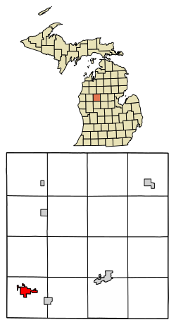 Location of Reed City, Michigan | |
Coordinates: 43°52.5′N 85°30.6′W / 43.8750°N 85.5100°W / 43.8750; -85.5100Coordinates: 43°52.5′N 85°30.6′W / 43.8750°N 85.5100°W / 43.8750; -85.5100 | |
| Country | United States |
| State | Michigan |
| County | Osceola |
| Area[1] | |
| • Total | 2.11 sq mi (5.46 km2) |
| • Land | 2.08 sq mi (5.39 km2) |
| • Water | 0.03 sq mi (0.08 km2) |
| Elevation | 1,040 ft (317 m) |
| Population (2010)[2] | |
| • Total | 2,425 |
| • Estimate (2016)[3] | 2,385 |
| • Density | 1,100/sq mi (440/km2) |
| Time zone | UTC-5 (Eastern (EST)) |
| • Summer (DST) | UTC-4 (EDT) |
| ZIP code | 49677 |
| Area code(s) | 231 |
| FIPS code | 26-67820[4] |
GNIS feature ID | 1621363[5] |
Reed City is a city in the U.S. state of Michigan. The population was 2,425 at the 2010 census. It is located in southwestern Osceola County and is the county seat.[6]
Contents
1 Geography
2 Demographics
2.1 2010 census
2.2 2000 census
3 Infrastructure
3.1 Transportation
4 Notable people
5 External links
6 References
Geography[edit]
According to the United States Census Bureau, the city has a total area of 2.11 square miles (5.46 km2), of which 2.08 square miles (5.39 km2) is land and 0.03 square miles (0.08 km2) is water.[1]
The Hersey River flows through Reed City.
Demographics[edit]
| Historical population | |||
|---|---|---|---|
| Census | Pop. | %± | |
| 1880 | 1,091 | — | |
| 1890 | 1,776 | 62.8% | |
| 1900 | 2,051 | 15.5% | |
| 1910 | 1,690 | −17.6% | |
| 1920 | 1,803 | 6.7% | |
| 1930 | 1,792 | −0.6% | |
| 1940 | 1,845 | 3.0% | |
| 1950 | 2,241 | 21.5% | |
| 1960 | 2,184 | −2.5% | |
| 1970 | 2,286 | 4.7% | |
| 1980 | 2,221 | −2.8% | |
| 1990 | 2,379 | 7.1% | |
| 2000 | 2,430 | 2.1% | |
| 2010 | 2,425 | −0.2% | |
| Est. 2016 | 2,385 | [3] | −1.6% |
| U.S. Decennial Census[7] | |||
2010 census[edit]
As of the census[2] of 2010, there were 2,425 people, 1,007 households, and 582 families residing in the city. The population density was 1,165.9 inhabitants per square mile (450.2/km2). There were 1,136 housing units at an average density of 546.2 per square mile (210.9/km2). The racial makeup of the city was 94.8% White, 1.7% African American, 0.5% Native American, 0.2% Asian, 0.3% from other races, and 2.5% from two or more races. Hispanic or Latino of any race were 2.2% of the population.
There were 1,007 households of which 33.3% had children under the age of 18 living with them, 35.3% were married couples living together, 16.8% had a female householder with no husband present, 5.8% had a male householder with no wife present, and 42.2% were non-families. 38.7% of all households were made up of individuals and 15.6% had someone living alone who was 65 years of age or older. The average household size was 2.26 and the average family size was 2.98.
The median age in the city was 36.1 years. 26.4% of residents were under the age of 18; 9.6% were between the ages of 18 and 24; 25.1% were from 25 to 44; 21.4% were from 45 to 64; and 17.5% were 65 years of age or older. The gender makeup of the city was 44.9% male and 55.1% female.
2000 census[edit]
As of the census[4] of 2000, there were 2,430 people, 999 households, and 609 families residing in the city. The population density was 1,265.3 per square mile (488.7/km²). There were 1,090 housing units at an average density of 567.5 per square mile (219.2/km²). The racial makeup of the city was 95.84% White, 1.07% African American, 0.74% Native American, 0.21% Asian, 0.12% from other races, and 2.02% from two or more races. Hispanic or Latino of any race were 0.91% of the population.
There were 999 households out of which 31.2% had children under the age of 18 living with them, 40.2% were married couples living together, 16.4% had a female householder with no husband present, and 39.0% were non-families. 33.4% of all households were made up of individuals and 14.4% had someone living alone who was 65 years of age or older. The average household size was 2.30 and the average family size was 2.93.
In the city, the population was spread out with 25.6% under the age of 18, 11.4% from 18 to 24, 25.4% from 25 to 44, 19.8% from 45 to 64, and 17.7% who were 65 years of age or older. The median age was 36 years. For every 100 females, there were 84.2 males. For every 100 females age 18 and over, there were 80.8 males.
The median income for a household in the city was $30,756, and the median income for a family was $42,340. Males had a median income of $29,375 versus $25,263 for females. The per capita income for the city was $15,889. About 10.9% of families and 17.9% of the population were below the poverty line, including 16.6% of those under age 18 and 14.2% of those age 65 or over.
Infrastructure[edit]
Transportation[edit]
Two of the state's premier rail trails intersect in the city:
- White Pine Trail
- Pere Marquette Trail
The city is also at the crossroads of two US highways:
 US 10
US 10 US 131
Indian Trails provides daily intercity bus service between Grand Rapids and Petoskey, Michigan.[8]
Notable people[edit]
George Bennard, American composer and preacher best known for composing the hymn, "The Old Rugged Cross." Bennard retired to Reed City, where he died on October 10, 1958.
William C. Giese, member of the Wisconsin State Assembly and educator, was born in Reed City on April 18, 1886.[9]
Thomas D. Schall, U.S. Representative from Minnesota's 10th congressional district (1915–1925) and U.S. Senator from Minnesota (1925–1935), he was born in Reed City on June 4, 1878.
External links[edit]
- Reed City Web Site
References[edit]
^ ab "US Gazetteer files 2010". United States Census Bureau. Archived from the original on 2011-02-20. Retrieved 2012-11-25.
^ ab "American FactFinder". United States Census Bureau. Retrieved 2012-11-25.
^ ab "Population and Housing Unit Estimates". Retrieved June 9, 2017.
^ ab "American FactFinder". United States Census Bureau. Retrieved 2008-01-31.
^ "US Board on Geographic Names". United States Geological Survey. 2007-10-25. Retrieved 2008-01-31.
^ "Find a County". National Association of Counties. Retrieved 2011-06-07.
^ "Census of Population and Housing". Census.gov. Retrieved June 4, 2015.
^ "GRAND RAPIDS-CADILLAC-TRAVERSE CITY-PETOSKEY" (PDF). Indian Trails. January 15, 2013. Retrieved 2013-03-09. [permanent dead link]
^ 'Wisconsin Blue Book 1954,' Biographical Sketch of William C. Giese, pg. 60
Municipalities and communities of Osceola County, Michigan, United States | ||
|---|---|---|
County seat: Reed City | ||
| City |
|  |
| Villages |
| |
| Townships |
| |
Categories:
- Cities in Osceola County, Michigan
- County seats in Michigan
(window.RLQ=window.RLQ||).push(function()mw.config.set("wgPageParseReport":"limitreport":"cputime":"0.496","walltime":"0.592","ppvisitednodes":"value":4523,"limit":1000000,"ppgeneratednodes":"value":0,"limit":1500000,"postexpandincludesize":"value":62094,"limit":2097152,"templateargumentsize":"value":9073,"limit":2097152,"expansiondepth":"value":23,"limit":40,"expensivefunctioncount":"value":3,"limit":500,"unstrip-depth":"value":0,"limit":20,"unstrip-size":"value":8975,"limit":5000000,"entityaccesscount":"value":1,"limit":400,"timingprofile":["100.00% 525.828 1 -total"," 50.00% 262.891 1 Template:Infobox_settlement"," 32.13% 168.973 1 Template:Infobox"," 21.64% 113.803 1 Template:Reflist"," 12.09% 63.594 8 Template:Cite_web"," 9.30% 48.905 1 Template:US_Census_population"," 8.87% 46.662 5 Template:Convert"," 8.26% 43.455 1 Template:Short_description"," 6.75% 35.473 1 Template:Coord"," 6.60% 34.693 16 Template:Rnd"],"scribunto":"limitreport-timeusage":"value":"0.221","limit":"10.000","limitreport-memusage":"value":7283336,"limit":52428800,"cachereport":"origin":"mw2232","timestamp":"20180920164524","ttl":1900800,"transientcontent":false);mw.config.set("wgBackendResponseTime":92,"wgHostname":"mw2277"););

 Clash Royale CLAN TAG