File:USA New York City location map.svg
File:USA New York City location map.svg
Jump to navigation
Jump to search
- File
- File history
- File usage
- Global file usage
- Metadata
Size of this PNG preview of this SVG file: 634 × 600 pixels. Other resolutions: 254 × 240 pixels | 507 × 480 pixels | 812 × 768 pixels | 1,082 × 1,024 pixels | 800 × 757 pixels.
Original file (SVG file, nominally 800 × 757 pixels, file size: 418 KB)
| This is a file from the Wikimedia Commons. Information from its description page there is shown below. Commons is a freely licensed media file repository. You can help. |
Summary[edit]
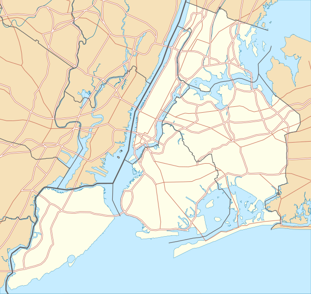
| DescriptionUSA New York City location map.svg | Deutsch: Positionskarte von New York City, USA Quadratische Plattkarte, N-S-Streckung 130.0 %. Geographische Begrenzung der Karte:
English: Location map of New York City, USA Equirectangular projection, N/S stretching 130.0 %. Geographic limits of the map:
| ||
| Date | 2 January 2010 | ||
| Source | Own work
| ||
| Author | Alexrk2 | ||
| Permission (Reusing this file) | All OpenStreetMap data and maps are Creative Commons "CC-BY-SA 2.0" licensed | ||
| Other versions | Derivative works of this file: Panorama map.jpg |
 | This map has been made or improved in the German Kartenwerkstatt (Map Lab). You can propose maps to improve as well. |
Licensing[edit]
I, the copyright holder of this work, hereby publish it under the following licenses:
 | Permission is granted to copy, distribute and/or modify this document under the terms of the GNU Free Documentation License, Version 1.2 or any later version published by the Free Software Foundation; with no Invariant Sections, no Front-Cover Texts, and no Back-Cover Texts. A copy of the license is included in the section entitled GNU Free Documentation License.http://www.gnu.org/copyleft/fdl.htmlGFDLGNU Free Documentation Licensetruetrue |
| This file is licensed under the Creative Commons Attribution 3.0 Unported license. | ||
https://creativecommons.org/licenses/by/3.0 |
You may select the license of your choice.
File history
Click on a date/time to view the file as it appeared at that time.
| Date/Time | Thumbnail | Dimensions | User | Comment | |
|---|---|---|---|---|---|
| current | 22:57, 2 January 2010 |  | 800 × 757 (418 KB) | Alexrk2 | roads under boundaries |
| 22:54, 2 January 2010 |  | 800 × 757 (418 KB) | Alexrk2 | changed road signature | |
| 13:25, 2 January 2010 |  | 800 × 757 (482 KB) | Alexrk2 | == int:filedesc == {{Information |Description= Positionskarte von New York City, USA Quadratische Plattkarte, N-S-Streckung 130.0 %. Geographische Begrenzung der Karte: * N: 40.92° N * S: 40.49° N * W: 74.27� |
File usage
More than 100 pages use this file.
The following list shows the first 100 pages that use this file only.
A full list is available.
- 103rd Street (IRT Lexington Avenue Line)
- 110th Street (IRT Lexington Avenue Line)
- 163rd Street–Amsterdam Avenue (IND Eighth Avenue Line)
- 18th Street (IRT Lexington Avenue Line)
- 23rd Street (IRT Lexington Avenue Line)
- 28th Street (IRT Lexington Avenue Line)
- 30 Rockefeller Plaza
- 40 Wall Street
- 4 Times Square
- 68th Street–Hunter College (IRT Lexington Avenue Line)
- 70 Pine Street
- 77th Street (IRT Lexington Avenue Line)
- 7 World Trade Center
- 86th Street (IRT Lexington Avenue Line)
- 96th Street (IRT Lexington Avenue Line)
- Apollo Theater
- Astor Place (IRT Lexington Avenue Line)
- Bayonne Bridge
- Belmont Park
- Bronx High School of Science
- Brooklyn Academy of Music
- Brooklyn Bridge
- Brooklyn Museum
- Brooklyn Technical High School
- Carroll Gardens, Brooklyn
- Cemetery of the Evergreens
- Charlie Parker
- Chrysler Building
- City Hall (IRT Lexington Avenue Line)
- City University of New York
- Clay Pit Ponds State Park Preserve
- Clifton, Staten Island
- Cobble Hill Tunnel
- Cross Bay Veterans Memorial Bridge
- Dumbo, Brooklyn
- East Village, Manhattan
- Ebbets Field
- Ellis Island
- Empire State Building
- Erasmus Hall High School
- Fiorello H. LaGuardia High School
- Flatiron Building
- Flushing Meadows–Corona Park
- Fordham University
- Fort Schuyler
- Fraunces Tavern
- George Washington Bridge
- Goethals Bridge
- Governors Island
- Governors Island National Monument
- Grand Army Plaza
- Grand Central Terminal
- Grant's Tomb
- Greenwich Village
- Headquarters of the United Nations
- Hell Gate Bridge
- Henry Hudson Bridge
- Hotel Chelsea
- Intrepid Sea, Air & Space Museum
- Jackson Heights, Queens
- John F. Kennedy International Airport
- LaGuardia Airport
- Liberty Island
- Little Red Lighthouse
- Long Island City
- Madison Square Garden
- Manhattan Bridge
- Marine Parkway–Gil Hodges Memorial Bridge
- Metropolitan Museum of Art
- New Utrecht Reformed Church
- New York City Hall
- Noguchi Museum
- Old Stone House (Brooklyn)
- One Worldwide Plaza
- Outerbridge Crossing
- Pelham Bay Park
- Queensboro Bridge
- Queens–Midtown Tunnel
- Rockefeller Center
- Saint Thomas Church (Manhattan)
- Shea Stadium
- SoHo, Manhattan
- Socrates Sculpture Park
- Solomon R. Guggenheim Museum
- South Street Seaport
- Spring Street (IRT Lexington Avenue Line)
- St. Patrick's Cathedral (Manhattan)
- Statue of Liberty
- Stuyvesant High School
- The Cloisters
- The Dakota
- Throgs Neck Bridge
- Todt Hill
- Triborough Bridge
- Trinity Church Cemetery
- USS Intrepid (CV-11)
- Union Theological Seminary (New York City)
- Verrazzano-Narrows Bridge
- Whitney Museum of American Art
- Woodlawn Cemetery (Bronx, New York)
Global file usage
The following other wikis use this file:
- Usage on ar.wikipedia.org
- تمثال الحرية
- مطار جون إف كينيدي الدولي
- شارع 200 غرينيتش
- تحالف الحضارات
- متحف سولومون غاغينهايم
- مركز التجارة العالمي 3
- الجانب الغربي الشمالي لمنهاتن
- Usage on arz.wikipedia.org
- قالب:Infobox historic site
- قالب:Infobox historic site/doc
- قالب:Location map USA New York City
- Usage on az.wikipedia.org
- Şablon:Yer xəritəsi ABŞ Nyu-York
- İst-River boğazı (çay)
- Kill-van-Kull
- 238-ci strit (Brodvey-Yeddinci avenyu xətti, IRT)
- Van-Kortlandt-Park–242-ci strit (Brodvey-Yeddinci avenyu xətti, IRT)
- İstifadəçi:JohnBlackburne
- Usage on ba.wikipedia.org
- Эмпайр-стейт-билдинг
- Ҡалып:ПозКарта США Нью-Йорк Нью-Йорк
- Usage on be.wikipedia.org
- Шаблон:На карце/ЗША Горад Нью-Ёрк
- Usage on bg.wikipedia.org
- Статуя на Свободата
- Колумбийски университет
- Емпайър Стейт Билдинг
- Бруклински мост
- Манхатънски мост
- Уилямсбъргски мост
- Куинсбъро Бридж
- Музей Соломон Гугенхайм
- Хел Гейт (мост)
- Световен търговски център 1
- Шаблон:ПК САЩ Ню Йорк
- Световен търговски център 7
- Usage on bh.wikipedia.org
- टेम्पलेट:Infobox historic site
- टेम्पलेट:Infobox historic site/doc
- स्टैच्यू ऑफ लिबर्टी
- Module:Location map/data/USA New York City/doc
- Module:Location map/data/USA New York City
- Usage on bn.wikipedia.org
- টেমপ্লেট:অবস্থান মানচিত্র মার্কিন যুক্তরাষ্ট্র নিউ ইয়র্ক সিটি
- অ্যাস্টোরিয়া, কুইন্স
- Usage on ca.wikipedia.org
- Plantilla:Location map USA Nova York
- Usage on ceb.wikipedia.org
- Plantilya:Location map USA New York City
- Usage on cs.wikipedia.org
- Brooklynský most
- Šablona:LocMap New York (město)
- Usage on da.wikipedia.org
- Times Square
- Bruger:A3ng3l/sandkasse1
- Skabelon:Kortpositioner New York City
- Agern (restaurant)
- Washington-broen
View more global usage of this file.
Metadata
(window.RLQ=window.RLQ||).push(function()mw.config.set("wgBackendResponseTime":202,"wgHostname":"mw1245"););