National Register of Historic Places listings in Union County, North Carolina
National Register of Historic Places listings in Union County, North Carolina
Jump to navigation
Jump to search

This list includes properties and districts listed on the National Register of Historic Places in Union County, North Carolina. Click the "Map of all coordinates" link to the right to view a Google map of all properties and districts with latitude and longitude coordinates in the table below.[1]
Current listings[edit]
This National Park Service list is complete through NPS recent listings posted December 21, 2018.[2]
| [3] | Name on the Register[4] | Image | Date listed[5] | Location | City or town | Description |
|---|---|---|---|---|---|---|
1 | Malcolm K. Lee House |  | January 5, 1988 (#87002200) | Main Street 34°58′39″N 80°32′03″W / 34.9773657°N 80.5342712°W / 34.9773657; -80.5342712 (Malcolm K. Lee House) | Monroe | Currently operating as a funeral home |
2 | Monroe City Hall |  | July 27, 1971 (#71000619) | 102 W. Jefferson St. 34°59′01″N 80°32′59″W / 34.983481°N 80.54965°W / 34.983481; -80.54965 (Monroe City Hall) | Monroe | |
3 | Monroe Downtown Historic District |  | January 6, 1988 (#87002202) | Roughly bounded by Jefferson, Church, Windsor & Stewart Sts. 34°58′55″N 80°33′00″W / 34.981944°N 80.55°W / 34.981944; -80.55 (Monroe Downtown Historic District) | Monroe | |
4 | Monroe Residential Historic District |  | January 6, 1988 (#87002204) | Roughly bounded by Hough, Franklin, Jefferson, McCarten, Windsor, Sanford, Washington. Braden, Church & Hudson Sts. 34°58′45″N 80°33′01″W / 34.979167°N 80.550278°W / 34.979167; -80.550278 (Monroe Residential Historic District) | Monroe | |
5 | Piedmont Buggy Factory |  | June 2, 2004 (#04000569) | 514 Miller St. 34°59′20″N 80°32′46″W / 34.988889°N 80.546111°W / 34.988889; -80.546111 (Piedmont Buggy Factory) | Monroe | |
6 | Pleasant Grove Camp Meeting Ground |  | April 3, 1973 (#73001370) | NE of Waxhaw on SR 1327 34°57′18″N 80°41′02″W / 34.955089°N 80.683967°W / 34.955089; -80.683967 (Pleasant Grove Camp Meeting Ground) | Waxhaw | |
7 | John C. Sikes House |  | April 15, 1982 (#82003518) | 1301 E. Franklin St. 34°58′31″N 80°31′37″W / 34.975175°N 80.52705°W / 34.975175; -80.52705 (John C. Sikes House) | Monroe | |
8 | Union County Courthouse |  | June 24, 1971 (#71000620) | Courthouse Sq. 34°58′59″N 80°33′00″W / 34.982958°N 80.549903°W / 34.982958; -80.549903 (Union County Courthouse) | Monroe | |
9 | US Post Office-Monroe | 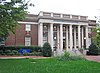 | March 6, 1985 (#85000482) | 407 N. Main St. 34°59′01″N 80°33′03″W / 34.983611°N 80.550833°W / 34.983611; -80.550833 (US Post Office-Monroe) | Monroe | |
10 | Waxhaw Historic District |  | December 6, 1991 (#91001773) | Portions of Main, Broad, Church, Broom, Providence, Old Providence, Brevard and McKibben Sts. 34°55′25″N 80°44′39″W / 34.923611°N 80.744167°W / 34.923611; -80.744167 (Waxhaw Historic District) | Waxhaw | |
11 | Waxhaw-Weddington Roads Historic District |  | January 5, 1988 (#87002201) | Jct. of NC 75, NC 34 & W. Franklin St. 34°58′58″N 80°34′19″W / 34.982778°N 80.571944°W / 34.982778; -80.571944 (Waxhaw-Weddington Roads Historic District) | Monroe | |
12 | Wingate Commercial Historic District | December 1, 2014 (#14000992) | 203, 205, 207-209, 211 Main St. 34°59′03″N 80°26′56″W / 34.9841°N 80.4489°W / 34.9841; -80.4489 (Wingate Commercial Historic District) | Wingate |
See also[edit]
| Wikimedia Commons has media related to National Register of Historic Places in Union County, North Carolina. |
- National Register of Historic Places listings in North Carolina
- List of National Historic Landmarks in North Carolina
References[edit]
^ The latitude and longitude information provided in this table was derived originally from the National Register Information System, which has been found to be fairly accurate for about 99% of listings. For about 1% of NRIS original coordinates, experience has shown that one or both coordinates are typos or otherwise extremely far off; some corrections may have been made. A more subtle problem causes many locations to be off by up to 150 yards, depending on location in the country: most NRIS coordinates were derived from tracing out latitude and longitudes from USGS topographical quadrant maps created under the North American Datum of 1927, which differs from the current, highly accurate WGS84 GPS system used by most on-line maps. Chicago is about right, but NRIS longitudes in Washington are higher by about 4.5 seconds, and are lower by about 2.0 seconds in Maine. Latitudes differ by about 1.0 second in Florida. Some locations in this table may have been corrected to current GPS standards.
^ "National Register of Historic Places: Weekly List Actions". National Park Service, United States Department of the Interior. Retrieved on December 21, 2018.
^ Numbers represent an ordering by significant words. Various colorings, defined here, differentiate National Historic Landmarks and historic districts from other NRHP buildings, structures, sites or objects.
^ National Park Service (2008-04-24). "National Register Information System". National Register of Historic Places. National Park Service..mw-parser-output cite.citationfont-style:inherit.mw-parser-output qquotes:"""""""'""'".mw-parser-output code.cs1-codecolor:inherit;background:inherit;border:inherit;padding:inherit.mw-parser-output .cs1-lock-free abackground:url("//upload.wikimedia.org/wikipedia/commons/thumb/6/65/Lock-green.svg/9px-Lock-green.svg.png")no-repeat;background-position:right .1em center.mw-parser-output .cs1-lock-limited a,.mw-parser-output .cs1-lock-registration abackground:url("//upload.wikimedia.org/wikipedia/commons/thumb/d/d6/Lock-gray-alt-2.svg/9px-Lock-gray-alt-2.svg.png")no-repeat;background-position:right .1em center.mw-parser-output .cs1-lock-subscription abackground:url("//upload.wikimedia.org/wikipedia/commons/thumb/a/aa/Lock-red-alt-2.svg/9px-Lock-red-alt-2.svg.png")no-repeat;background-position:right .1em center.mw-parser-output .cs1-subscription,.mw-parser-output .cs1-registrationcolor:#555.mw-parser-output .cs1-subscription span,.mw-parser-output .cs1-registration spanborder-bottom:1px dotted;cursor:help.mw-parser-output .cs1-hidden-errordisplay:none;font-size:100%.mw-parser-output .cs1-visible-errorfont-size:100%.mw-parser-output .cs1-subscription,.mw-parser-output .cs1-registration,.mw-parser-output .cs1-formatfont-size:95%.mw-parser-output .cs1-kern-left,.mw-parser-output .cs1-kern-wl-leftpadding-left:0.2em.mw-parser-output .cs1-kern-right,.mw-parser-output .cs1-kern-wl-rightpadding-right:0.2em
^ The eight-digit number below each date is the number assigned to each location in the National Register Information System database, which can be viewed by clicking the number.
U.S. National Register of Historic Places in North Carolina | ||
|---|---|---|
| Topics |
|   |
| Lists by county |
| |
| Other lists |
| |
U.S. National Register of Historic Places | |
|---|---|
| Topics |
|
| Lists by states |
|
| Lists by insular areas |
|
| Lists by associated states |
|
| Other areas |
|
| |
Municipalities and communities of Union County, North Carolina, United States | ||
|---|---|---|
County seat: Monroe | ||
| City |
|  |
| Towns |
| |
| Villages |
| |
| CDP |
| |
| Unincorporated communities |
| |
| Ghost town |
| |
| Footnotes | ‡This populated place also has portions in an adjacent county or counties | |
Categories:
- Union County, North Carolina
- Lists of National Register of Historic Places in North Carolina by county
- Buildings and structures in Union County, North Carolina
- National Register of Historic Places in Union County, North Carolina
(window.RLQ=window.RLQ||).push(function()mw.config.set("wgPageParseReport":"limitreport":"cputime":"0.440","walltime":"0.589","ppvisitednodes":"value":5793,"limit":1000000,"ppgeneratednodes":"value":0,"limit":1500000,"postexpandincludesize":"value":157517,"limit":2097152,"templateargumentsize":"value":8780,"limit":2097152,"expansiondepth":"value":11,"limit":40,"expensivefunctioncount":"value":0,"limit":500,"unstrip-depth":"value":1,"limit":20,"unstrip-size":"value":5504,"limit":5000000,"entityaccesscount":"value":0,"limit":400,"timingprofile":["100.00% 430.820 1 -total"," 35.81% 154.291 12 Template:NRHP_row"," 26.24% 113.052 1 Template:NRHP_header"," 20.47% 88.204 1 Template:NRISref"," 19.49% 83.954 1 Template:Cite_web"," 14.38% 61.938 1 Template:Commons_category"," 9.98% 42.975 3 Template:Navbox"," 8.65% 37.267 13 Template:Designation/color"," 7.81% 33.661 12 Template:Coord"," 7.68% 33.087 25 Template:First_word"],"scribunto":"limitreport-timeusage":"value":"0.156","limit":"10.000","limitreport-memusage":"value":3561893,"limit":52428800,"cachereport":"origin":"mw1266","timestamp":"20181228021824","ttl":1900800,"transientcontent":false);mw.config.set("wgBackendResponseTime":690,"wgHostname":"mw1266"););

 Clash Royale CLAN TAG